


MyRadar
News
—
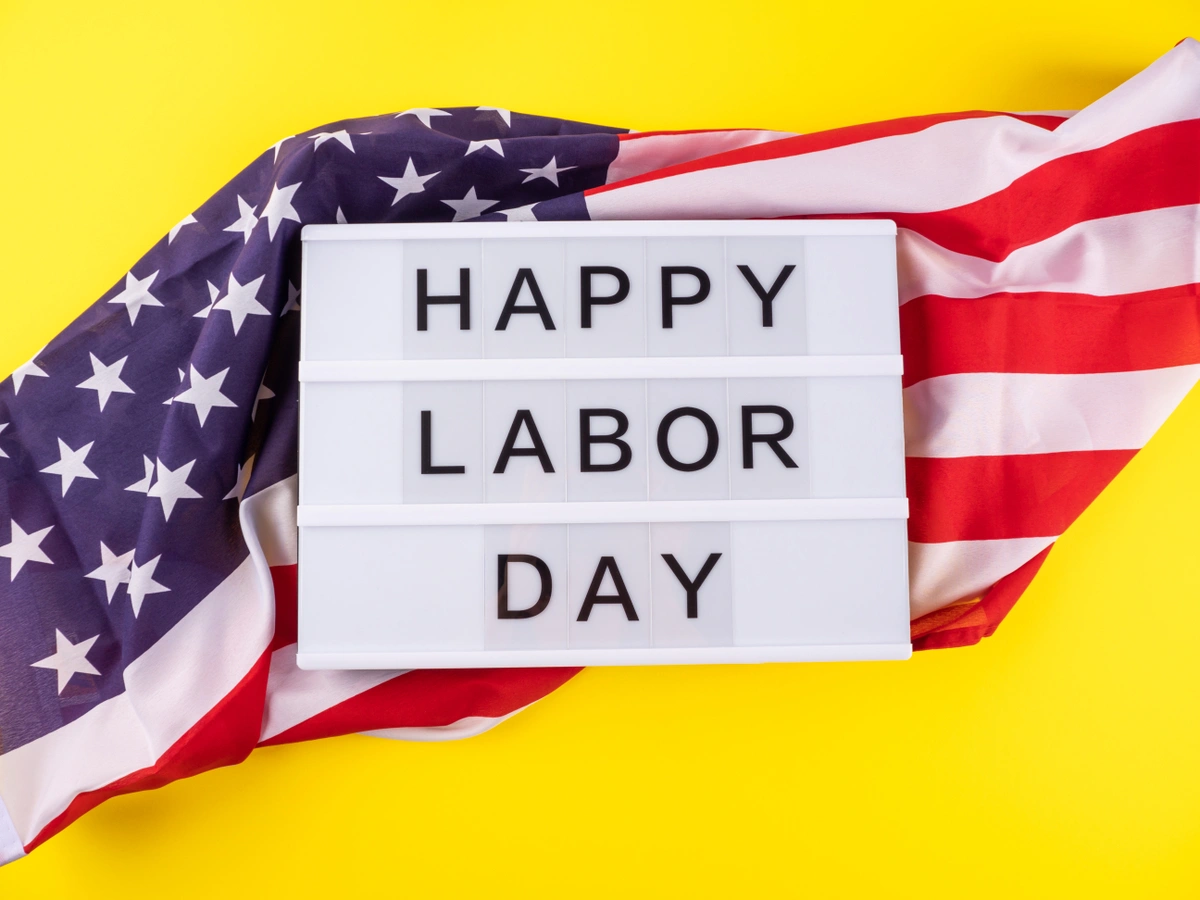
Where you are in the Central U.S. will determine if your Labor Day is mild or scorching
by Gunnar Consol | News Contributor
9/5/2022
Who doesn't love labor day? It's a day where many of us get to enjoy a day off from work all thanks to the pro-labor movements of the late 1800s.
Nowadays, Labor Day typically caps off the end of the summer activities season as we approach the fall equinox on September 22nd. With it still technically being summer, that means we can't be surprised when summertime heat rears its head even though the pumpkin spiced lattes have returned. Trust me, I'm sipping a pumpkin cream cold brew as I write this, and it is in the upper-80s in my home base of Evansville, Indiana right now!
So as we gear up to plan our Labor Day weekends, what can we expect? Who will see a scorching Labor Day and who will see a warm and mild one? Basically, it all has to do with highs and lows and their corresponding surface level winds.
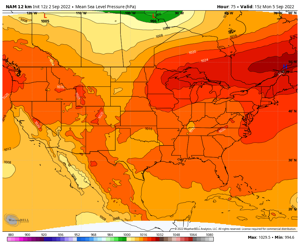
Figure 1: Mean Sea Level Pressure forecast for Monday, September 5th, 2022.
Above you'll see the figure I'll be mentioning for a bit. For our Labor Day, the forecast will be split half-and-half down the middle. It'll be a scorching west Central U.S. and a mild east Central U.S., but why? In Figure 1, high pressure will dominate from southern Ontario and Quebec, and a low pressure will slide over northern Manitoba. Even though these are going to be centered over Canada, this is the driving factor in our American holiday forecast.
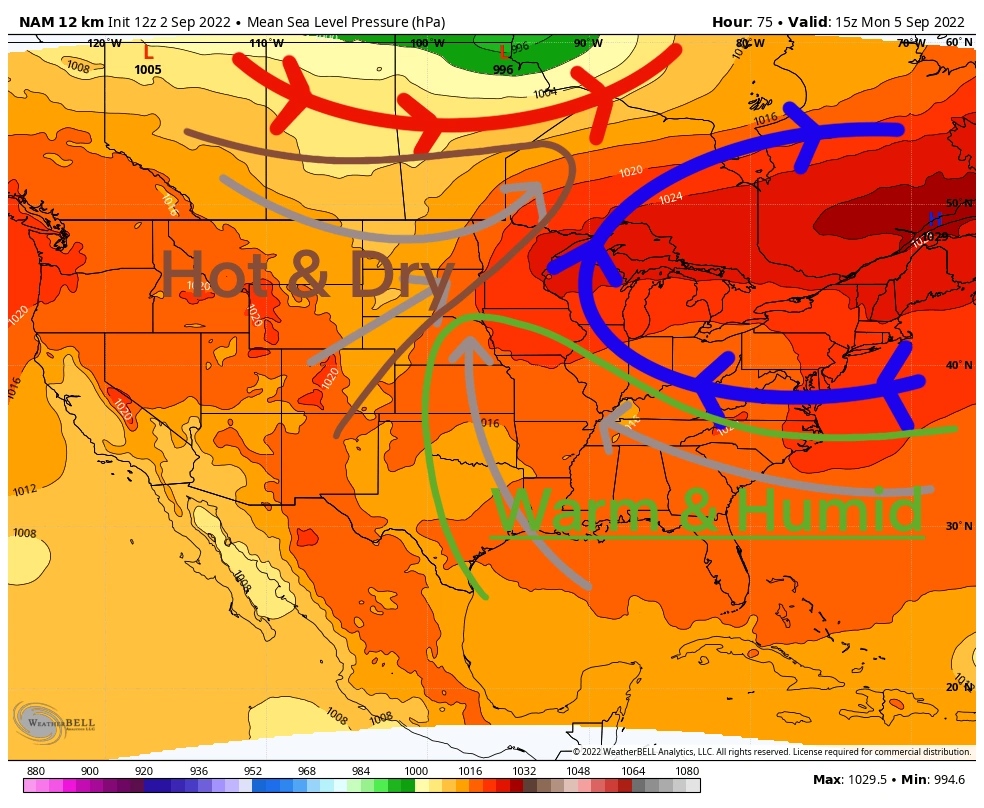
Figure 2: Mean Sea Level Pressure forecast for Monday, September 5th, 2022. [Self Annotated]
To help aid in the discussion, I've annotated Figure 1 to create Figure 2. The blue line indicates the general wind flow around high pressure, and the red line indicates the general wind flow around low pressure. This will create a wind field that brings warm and humid air from the south toward the eastern Central U.S.. This will also create a wind field that brings hot and dry air from the southwest toward the western Central U.S.. Because it takes more energy to warm up water than air, more humid air is harder to warm up. But dry air has little water in it to slow its warming. As a result, we begin to see the puzzle pieces falling together for a Labor Day forecast that is split down the middle.
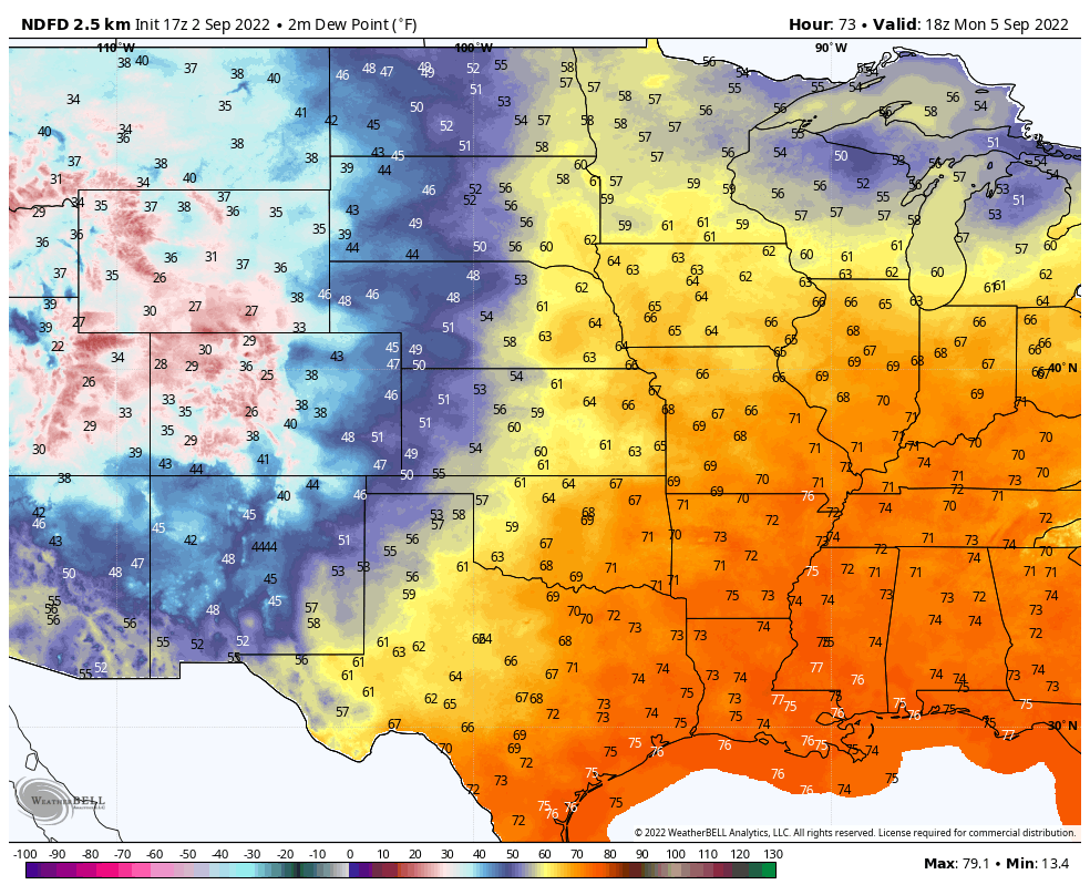
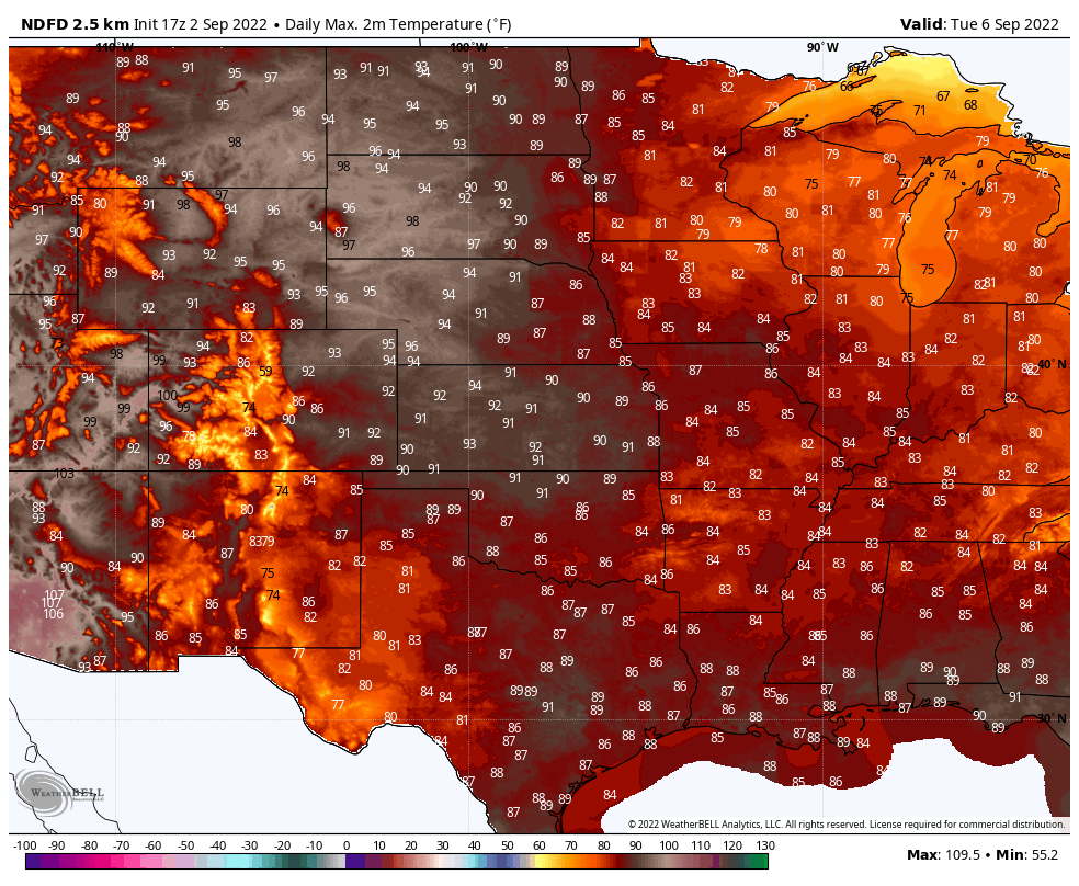
Figure 3 (left): Dewpoint (metric for humidity) forecast for Monday, September 5th, 2022. /// Figure 4 (right): Daily maximum high forecast for Monday, September 5th, 2022
This exact set-up will create a situation where both sides of the Central United States will have something to brag over and complain about. Based off Figure 3, you can see humidity is going to be much more bearable in the west which means despite the scorching temperatures in Figure 4, it will be a dry heat. Meaning outdoor plans will still be comfortable as you won't be dripping in sweat. As for the eastern half of the heartland, temperatures won't be as hot (figure 4), but humidity will be borderline soupy (figure 3). This means that any outdoor barbecues goers will experience a sweat storm so-to-speak.
So while temperatures could be near 100° in some places in Montana, North Dakota, and South Dakota, and humidity will be soupy in Illinois, Indiana, and Missouri, if you can find yourself right in the middle to get the best of both worlds you've got it made this Labor Day. That means the winners for this Labor Day weather-wise are the Great Lakes states.
Although it may be September and fall is on our minds, it will still be awhile till we see that fall chill in the air. So despite the weather, enjoy the last summer holiday!